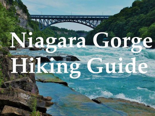
When you come to Niagara Falls, make sure you bring your hiking boots to explore the trails in and out of the Niagara Gorge. Each year, 13 million visitors make the journey to catch a glimpse of Niagara Falls, the honeymoon capital of the world. After staring in amazement at the thundering cascades, they then venture to the casinos and other various distractions around the area.
Little do people know, there are some world-class hiking trails around Niagara Falls. Though a leisurely troll around Goat Island may be enough for some visitors, the Niagara Gorge boasts eight trails for the more adventurous. In this guide, explore the five trailheads and the trails that lead to some of the most spectacular scenery in the world.

Map of trails in the Niagara Gorge 
Niagara Gorge Trail Descriptions
Safe Hiking Tips for the Niagara Gorge
Hiking, especially along the volatile Niagara River, can be a dangerous. Be sure to manage your risk appropriately by following these safe hiking suggestions.
- Before hiking, make sure you are physically fit enough for the rigors of the trail.
- Research the trail you are hiking on and be aware of any hazards you may find.
- File a “trip plan” with someone not hiking with you. It will let others know where you are and when you should be back.
- Always hike with a buddy.
- Wear sturdy footwear and appropriate clothing for the weather conditions. The Niagara Gorge is full of slippery jagged rocks.
- Always stay on the trail. The reason people get hurt while hiking in the Gorge is because they were walking where they shouldn’t have been.
- Carry the 10 Essentials with you, even for short hikes.
- Carrying a cell phone is not an excuse for being reckless; it may take rescuers hours to reach you in an emergency.
Niagara Gorge Trailheads
There are five main trailheads with good free public parking that afford access to the hiking trails in the Niagara Gorge. Be cautious that some of these trailheads can fill up quickly, especially during the summer tourist season.
- Niagara Gorge Discovery Center
- Whirlpool Bridge
- Whirlpool State Park
- Devils Hole State Park
- Art Park State Park.


Niagara Gorge Discovery Center
Before setting out on the trail, learn about the geological formation and rich history of the Niagara Gorge. An admission fee applies, but the limited parking is free. Be advised, that during the summer months this lot fills up quickly. You can catch one of the trolleys here to other points in the Falls as well.
From the Gorge Center, you can access several trails.
1) Rim Trail: 6.2 miles / Easy
2) Great Gorge Railway Trail: 1.1 miles / Moderate
3) American Falls Gorge Trail 1 mile / Difficult

Whirlpool Bridge Trailhead
The revitalized trailhead by the Whirlpool Bridge is barely known yet offers one of the best access points to get to the Great Gorge Route. On busy summer days and weekend when the Discovery Center parking lot is full, this lot offers a close alternative.
The trailhead is located under the Whirlpool Nexus Bridge and though it looks a bit sketchy, I haven’t heard of any incidents in the parking area. The trail, marked by a nice sign, descends by stairs just inside the treeline.


Whirlpool State Park
Whirlpool State Park is a shady and free place to park your vehicle while visiting the area. From the parking lot, walk 200 meters to the paved Rim Trail. From this point, you can look over the gigantic swirling Whirlpool. On sunny days, the Aero Car on the Canadian side takes people across this area of the Gorge.
Cross Robert Moses Parkway to reach De Veaux Woods, which offers a few miles of easy hiking, biking and nature observation.
It is also from this point, that most people descend into the Gorge to get an up close look at the Whirlpool.
From this park, you can access the following trails:
- Robert Moses Recreation Way
- Rim Trail
- Whirlpool-Rapids Trail.

Devil’s Hole State Park
The ominous-sounding Devil’s Hole is a large gulch that enters prominently into the Niagara Gorge just South of the Power Station. This landmark was once a waterfall itself, as it drained the ancient glacial Lake Tonawanda into the Niagara River. There are two free parking areas here on both sides of the road.
From Devil’s Hole you can access the following trails:
1) Rim Trail 6.2 miles / Easy
2) Devil’s Hole Trail 2.8 miles / moderate

Artpark State Park Trailhead
When Western New Yorkers hear Artpark, they think of the great concerts given throughout the year but realize the great hiking nearby. Though this trailhead offers excellent access to little-used yet spectacular trails, it is notoriously difficult for people to find.
For those of you navigating with a GPS, enter the latitude and longitude into the coordinates in your system. Here are the coordinates 43.162411, -79.044318.
As a word of advice, I would avoid using this trailhead while there is a concert in the evening.
Niagara Gorge Trails


Robert Moses Recreation Trail
Robert Moses Recreation Trail: 3.2 miles, Easy.
If hiking isn’t your speed, bring or rent a bike to explore the Niagara Gorge. Made for biking the length of the Gorge, this paved path stretches from Devil’s Hole State Park to the Niagara Gorge Discovery Center. Though the trail terminates at the Center, there are other paved bike paths that stretch from that area so you can ride to Prospect Point and Goat Island.
For most of this path, the Rim Trail runs parallel to the paved Robert Moses Parkway Trail. The Robert Moses PWT, is ideal for bike riding and jogging. At places, the Rim Trail and the Parkway Trail are the same and yes it can be confusing at times, so watch for abrupt changes of the path.
Though the path is paved and designated as a bike path, it does intersect with a couple of roads like at Whirlpool State Park, so watch for cross-traffic. There are plenty of spots to pull off of the path for exploration or picnicking.

Niagara Gorge Rim Trail
Rim Trail: 6.2 miles, Easy
For hikers not wishing to navigate the rough terrain at the bottom of the Gorge, and yet still see the natural beauty of the Falls, there is the Rim Trail. The Rim Trail extends 6.2 miles from Devil’s Hole State Park to Prospect Point overlooking Niagara Falls. From Prospect Point, it is an easy walk over the bridge to Goat Island for more views of the cascades.
Access the Rim Trail at the Gorge Discovery Center, Whirlpool State Park, or Devil’s Hole State Park.
American Falls Gorge Trail
American Falls Trail: 1 mile, moderate
Access this trail from the intersection with the Great Gorge Railway Trail at .75 miles. This trail take you to the home of the Old Schoellkopf Power Plant, which collapsed in 1956. Take caution as there is still a lot of debris in the area. At one time you could take this trail to the base of Niagara Falls; however, that trail is now closed. You must retrace your steps to exit. This is the only place in the bottom of the Gorge where you can actually see the Horseshoe Falls up the Niagara River.
You may also access this trail by using the elevator located at the Niagara Gorge Discovery Center. The elevator, descends to the Maid of the Mist drydock and meets up with the trail below. The trail extends south as well for an excellent view downriver. Though using the elevator makes an excellent loop, check the operating times of the elevator first. If the elevator is not running, you must turn around at the Maid of the Mist dock and return back the way you came.

Great Gorge Railway Trail
Great Gorge Railway Trail: 1.1 miles / Moderate
Access this trail off of the Rim Trail just north of the bridge that goes to the Aquarium. This level trail passes several scenic outlooks while descending gently into the Gorge. This trail ends at the double span Whirlpool Bridges. You can either retrace your steps or take the stairs up to the Whirlpool Bridge Trailhead.

Whirlpool Rapids Trail
Whirlpool Rapids Trail: 1.7 miles / Difficult
This is one of the most scenic and yet hazardous trails in the Niagara Falls area. To follow this trail, begin walking north along the Rim Trail until you reach the stairway heading down to the river. Descend the 300 stone steps with care. These stones were laid by CCC volunteers in the 1930s, and many are showing their age.
When you reach the Niagara, turn left and head toward the Whirlpool. A loop in the middle of this trail will take you to the Whirlpool Flats – a surreal area which is perfect for overlooking the wonders down there.
Keep walking on the trail until you reach an old stairway leading down to the River; this was once a stop along the railway that amazingly ran through this place.
The trail continues a little further until it is closed due to rock slides. You will see a rock spray painted with the words “end of trail.” For your safety, do not hike any further.

Devil’s Hole Trail
Devil’s Hole Trail: 1.25 miles / moderate
Utilizing other trails, this is one of the best hiking loops in Western New York. To hike this trail, take the stone stairs Devil’s Hole to the bottom of the Gorge. About a third of the way down the stairs you’ll meet with an intersection that will take you Devil’s Hole Cave and NYPA fishing access. This is a newly designated trail. At the bottom of the stairs, turning right will take you to a rough trail used by fishermen – it does lead to the access point at the Power Project.
Turn left (head south) at the Niagara River and proceed along a gentle path that parallels the water. Along the way, you’ll see Giant Rock, a few caves, and have numerous points to overlook the power of the Niagara.
To exit the Gorge, take the Whirlpool Stairs up to Whirlpool State Park. Take your time, many a pilgrim has slipped on these stairs with exhaustion. When you reach the top of the Gorge, take a left on the Rim Trail and head north toward Devil’s Hole. The total length of the loop is about 2.5 miles.

Artpark Gorge Trail
Artpark Gorge Trail: 1.3 miles / Easy to Moderate
This trail traverses along the Gorge till it reaches the rim near the Power Project. Along the way, you’ll see waterfalls, great views and a very healthy population of vultures soaring through the air. The trail starts off easily enough and emerges at a nice picnic area near the Spring Cave Cascade Waterfall.
Past this waterfall, you’ll encounter a trail that descends down to the River’s Edge Trail for a nice loop through this area. Though this is a newly designated trail, the stairs are quite rough and wobbly in places.
The trail passes under the Lewiston-Queenston bridge and at that point becomes more rugged as it passes through rock falls and narrower passages. In winter an ice cave appears under one of the overhangs and it is one of the best natural phenomenons in the area.
The trail winds along the top of the gorge and emerges out at a vista near the power project with excellent views up and down river. From there, you can go through the passage way in the fence and hike the Rim Trail to Devil’s Hole.

River’s Edge Trail
River’s Edge Trail: .7 miles / Easy to moderate
This trail takes you down to the edge of the mighty Niagara River with excellent access points for nature viewing and fishing. Several sets of stone stairs have been constructed to enable the River Access. It’s fantastic to see a huge steelhead being reeled in as you hike by.
The trail is fairly easy for most of the way, though there is a slight climb down and up from the parking lot. The trail winds down officially after .7 miles where it meets with a connector trail to the upper Artpark Gorge trail for a nice hiking loop.